UP THE RODING
An occasional blog about walking in the edgelands of North East London and various other places
There is no comments capability on this blog, but you can send me an email at blog@holli.co.uk
WALKING THE RIVER RODING FROM THAMES TO SOURCE
Leg 6: Upstream to Ongar
6 August 2016
I was at last able to return to Passingford Bridge, where the River Roding flows under the A113 on its way towards the suburbs of east London. This leg of my walk would take me upstream to the small market town of Chipping Ongar - but at Passingford the river was hemmed in on both sides by trees and bushes, so it wasn’t possible to start by simply walking alongside the Roding.

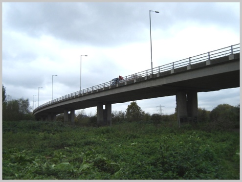
Fifty yards away was a narrow road, Albyns Lane, which I followed for about half-a-mile, and then turned off onto a track which ran alongside the river as it passed under the M25 orbital motorway. Unlike the motorway architecture in the earlier sections of the walk, there was nothing remotely inspiring about this passageway, even if it did represent my final leave-taking of London and its motorways.

The River Roding leaves London’s orbit
The river now made a large, gentle loop to the left, but I took a more direct route, following a track across the fields in crop, passing farm houses and those inescapable electricity pylons. Behind me, the sound of the continuous stream of lorries on the M25 slowly faded away.


No escape from the watchtowers, even in the countryside
The farm track rejoined the Roding and then led out to the bridge at Shonk’s Mill Road, where the river appeared to split into two narrow channels.

The Roding at Shonk’s Mill Bridge
I now had a decision to make. For the next couple of miles there are no paths or rights of way following the river, and hedges, fences, and drainage channels run down the fields all the way to the river-bank. Some years ago, I might have had a go at clambering over or through these obstacles - but I knew that I was unlikely to succeed with my dodgy knee, and therefore decided to follow the minor roads a quarter-mile or so east of the river.
Fortunately, these provided an hour of quiet, pleasant walking, since I was passed by only a handful of vehicles and a couple of cyclists. After about a mile I came to a road leading to the Secret Nuclear Bunker at Kelvedon Hatch. This used to be one of the Regional Seats of Government that would attempt to run the country in the event of a nuclear attack. Decommissioned in 1992, it is now privately owned and promises “loads to do for the whole family”. It does, however, seem to have been kept largely as it was during the Cold War.

“Keep out!” But they helpfully tell you that there is an entrance to the Secret Bunker from the main road

I guess it’s “Keep out!” here, as well.
After passing a number of large private residences, I reached the main road between Brentwood and Ongar. This had considerably more traffic, which I had to avoid by stepping off the road every minute or so, but fortunately it wasn’t too long before I reached the Roding again at Langford Bridge.


From here I walked along a field edge to find - at last! - a public footpath, which ran a few yards away from the Roding. There was just one problem …

I braved the nettles and brambles and eventually emerged at Hallsford Bridge, having picked up several good-looking scratches on my legs along the way. Crossing the road, I was at last able walk alongside the river.

After another half-mile, I turned uphill through fields which provided pasture for a herd of cows, and alongside a tributary of the Roding, Cripsey Brook, which led me into Chipping Ongar.

Approaching the outskirts of Ongar
This was a frustrating section of my trek up the Roding, as I had been forced to walk some distance away from the river. Fortunately the next leg, which will take me through Fyfield and towards the Roding villages, has many more footpaths and rights-of-way that should keep me closer to the river bank.